Salt Spring Island Archives

 163656.jpg
 163657.jpg
 163658.jpg
 163659.jpg
 163660.jpg
 163661.jpg
 163662.jpg
 163663.jpg
 163664.jpg
 163664L.jpg
 163665.jpg
 163665L.jpg
 163666.jpg
 163666L.jpg
 163667.jpg
 163667L.jpg
 163667B.jpg
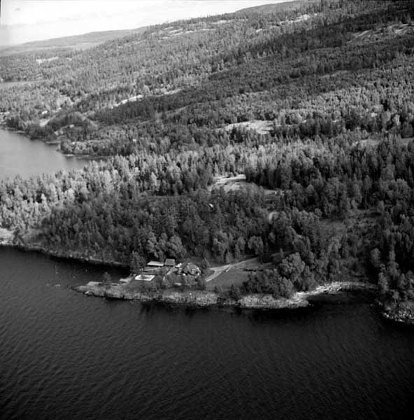
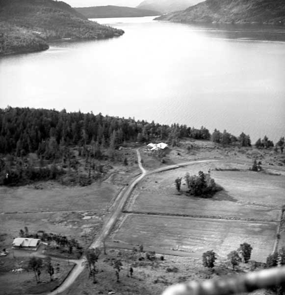
Gavin Mouat’s former farm in the background. Mountain Park Drive in the foreground.
Collection: Marshall Sharp Fond
Location: Salt Spring Island Archives
Date: circa 1970
Responsibility: Marshall Sharp
Source: Betty Taylor
Dimensions: 5.7cm x 5.7cm
Extent and Physical Description: black and white negative
Accession number: 163659
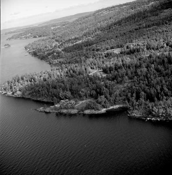
Gavin Mouat’s former farm in the background. Mountain Park Drive in the foreground.
Collection: Marshall Sharp Fond
Location: Salt Spring Island Archives
Date: circa 1970
Responsibility: Marshall Sharp
Source: Betty Taylor
Dimensions: 5.7cm x 5.7cm
Extent and Physical Description: black and white negative
Accession number: 163660
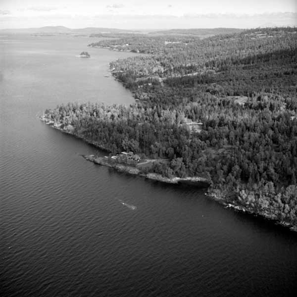
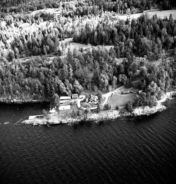
Simpson/Wilson house.
See also 163656 (four images back in this series)
Collection: Marshall Sharp Fond
Location: Salt Spring Island Archives
Date: circa 1970
Responsibility: Marshall Sharp
Source: Betty Taylor
Dimensions: 5.7cm x 5.7cm
Extent and Physical Description: black and white negative
Accession number: 163661
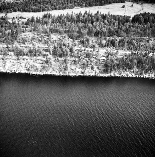
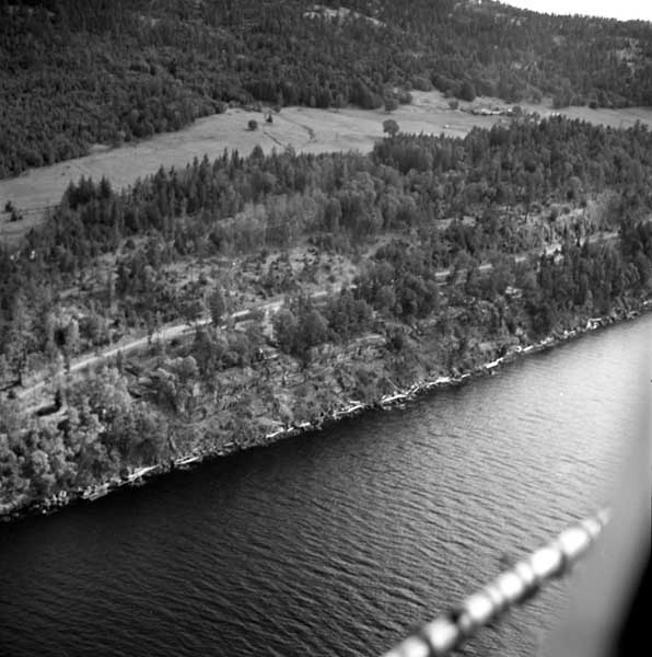
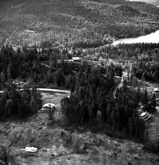
looking south down Sansum Narrows. Views from the top of Canvassback Drive in what is now Channel Ridge are very similar.
Anyone can identify the buildings?
Collection: Marshall Sharp Fond
Location: Salt Spring Island Archives
Date: circa 1970
Responsibility: Marshall Sharp
Source: Betty Taylor
Dimensions: 5.7cm x 5.7cm
Extent and Physical Description: black and white negative
Accession number: 163662
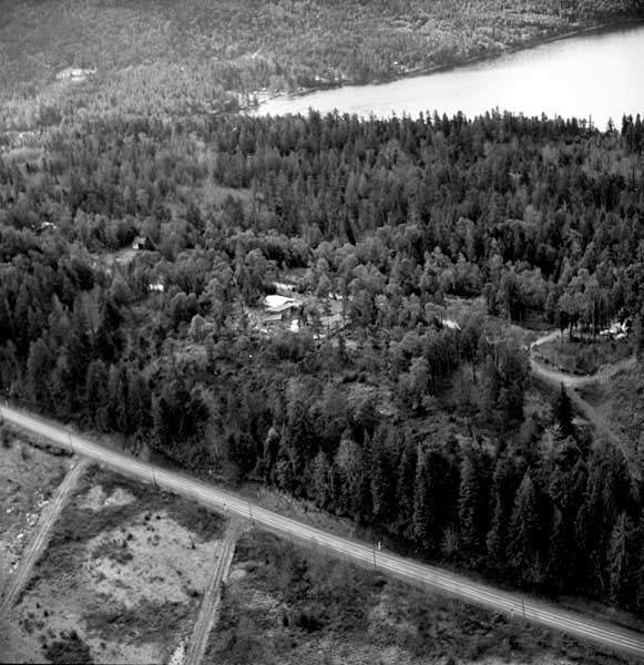
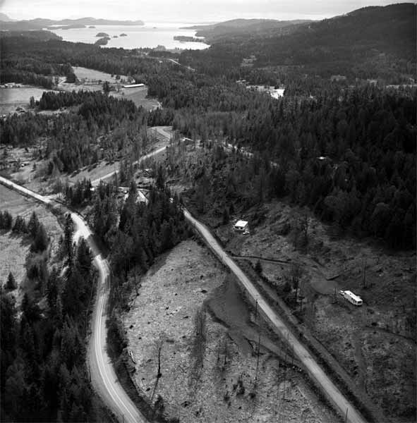
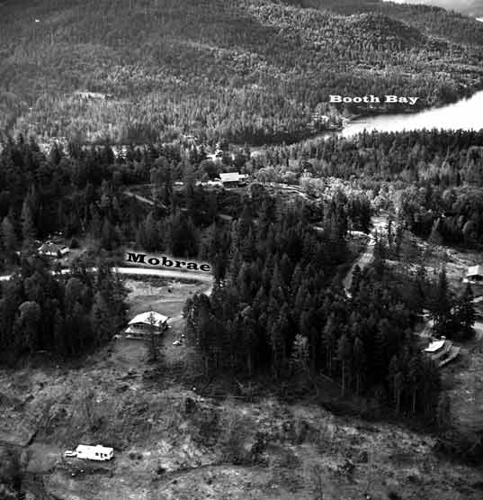
Probably Booth Bay in the background, and Vesuvius Bay Road in the foreground. (Therefore a portion of the Mobrae subdivision in between?).
Collection: Marshall Sharp Fond
Location: Salt Spring Island Archives
Date: circa 1970
Responsibility: Marshall Sharp
Source: Betty Taylor
Dimensions: 5.7cm x 5.7cm
Extent and Physical Description: black and white negative
Accession number: 163663
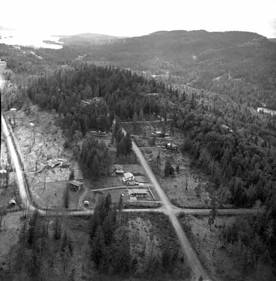
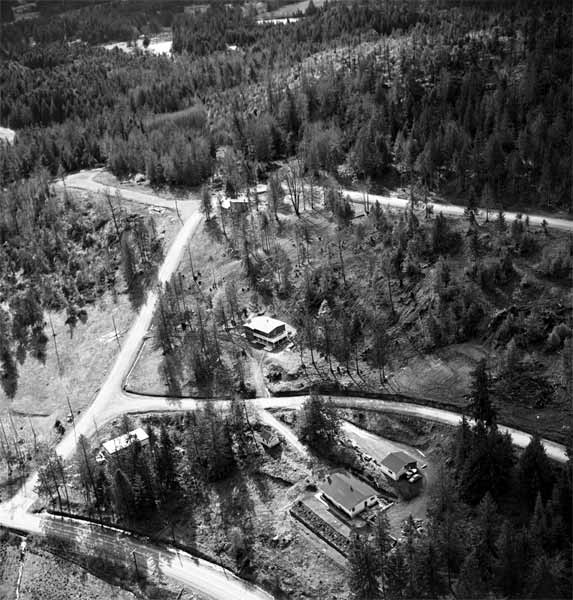
The small buildings on the right hand side near the end of the road on the left seem to be the same as those on the right hand side of Woodland Drive already identified in photo -665. Photo -664 would therefore be the intersection of Woodland (left and right) and Mobrae (straight ahead and below).
The following image has the roads identified.
Collection: Marshall Sharp Fond
Location: Salt Spring Island Archives
Date: circa 1970
Responsibility: Marshall Sharp
Source: Betty Taylor
Dimensions: 5.7cm x 5.7cm
Extent and Physical Description: black and white negative
Accession number: 163664
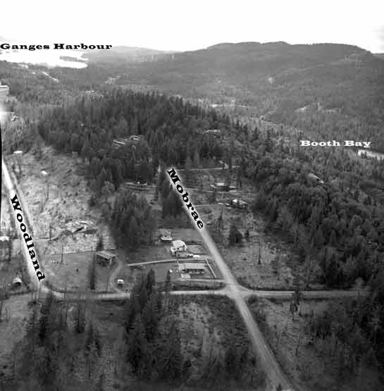
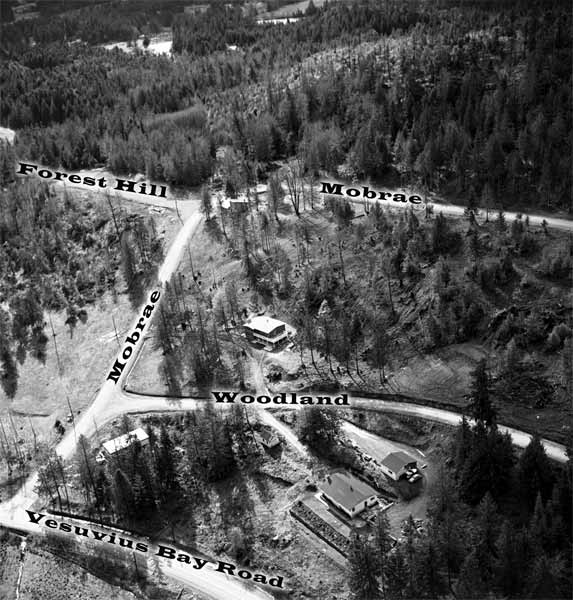
The small buildings on the right hand side near the end of the road on the left seem to be the same as those on the right hand side of Woodland Drive already identified in photo -665. Photo -664 would therefore be the intersection of Woodland (left and right) and Mobrae (straight ahead and below).
Same as previous image with roads identified.
Collection: Marshall Sharp Fond
Location: Salt Spring Island Archives
Date: circa 1970
Responsibility: Marshall Sharp
Source: Betty Taylor
Dimensions: 5.7cm x 5.7cm
Extent and Physical Description: black and white negative
Accession number: 163664L
The following image has the roads identified.
Collection: Marshall Sharp Fond
Location: Salt Spring Island Archives
Date: circa 1970
Responsibility: Marshall Sharp
Source: Betty Taylor
Dimensions: 5.7cm x 5.7cm
Extent and Physical Description: black and white negative
Accession number: 163665
Same as previous image with roads identified.
Collection: Marshall Sharp Fond
Location: Salt Spring Island Archives
Date: circa 1970
Responsibility: Marshall Sharp
Source: Betty Taylor
Dimensions: 5.7cm x 5.7cm
Extent and Physical Description: black and white negative
Accession number: 163665L
The following image has the roads identified.
Collection: Marshall Sharp Fond
Location: Salt Spring Island Archives
Date: circa 1970
Responsibility: Marshall Sharp
Source: Betty Taylor
Dimensions: 5.7cm x 5.7cm
Extent and Physical Description: black and white negative
Accession number: 163666
Same as previous image with roads identified.
Collection: Marshall Sharp Fond
Location: Salt Spring Island Archives
Date: circa 1970
Responsibility: Marshall Sharp
Source: Betty Taylor
Dimensions: 5.7cm x 5.7cm
Extent and Physical Description: black and white negative
Accession number: 163666L
The following image has the roads identified.
Collection: Marshall Sharp Fond
Location: Salt Spring Island Archives
Date: circa 1970
Responsibility: Marshall Sharp
Source: Betty Taylor
Dimensions: 5.7cm x 5.7cm
Extent and Physical Description: black and white negative
Accession number: 163667
Same as previous image with roads identified.
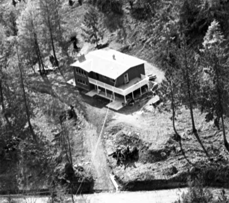
The following image is Bob and Donna’s house. :)
Collection: Marshall Sharp Fond
Location: Salt Spring Island Archives
Date: circa 1970
Responsibility: Marshall Sharp
Source: Betty Taylor
Dimensions: 5.7cm x 5.7cm
Extent and Physical Description: black and white negative
Accession number: 163667L
Detail from previous image
Bob and Donna’s house. :)
Collection: Marshall Sharp Fond
Location: Salt Spring Island Archives
Date: circa 1970
Responsibility: Marshall Sharp
Source: Betty Taylor
Dimensions: 5.7cm x 5.7cm
Extent and Physical Description: black and white negative
Accession number: 163667B

